Latest forecast for Category 1 Hurricane Ida
Ida has weakened to a Category 1 hurricane with maximum sustained winds of 75 miles per hour, as it continues to thrash Louisiana.
As of 1 a.m. CT, Ida was moving north at 9 miles per hour with the eye of the storm located about 20 miles south-southwest of Greensburg, Louisiana, and 45 miles from McComb, Mississippi, according to an advisory from the National Weather Service.
Ida is expected to continue heading north inland over southeastern Louisiana early Monday morning and later move into southwestern Mississippi, with further weakening forecast throughout the day. Ida is expected to be downgraded to a tropical storm later Monday morning, Nevertheless, the National Weather Service warned of continued threats from dangerous storm surge, damaging winds and flash flooding in parts of southeastern Louisiana.

In LaPlace, Louisiana, where up to 13 inches of rain has fallen from Ida so far, there were reports of high-water rescues to save residents trapped on top of homes amid completely flooded roads. The National Weather Service has extended a flash flood emergency for the area.
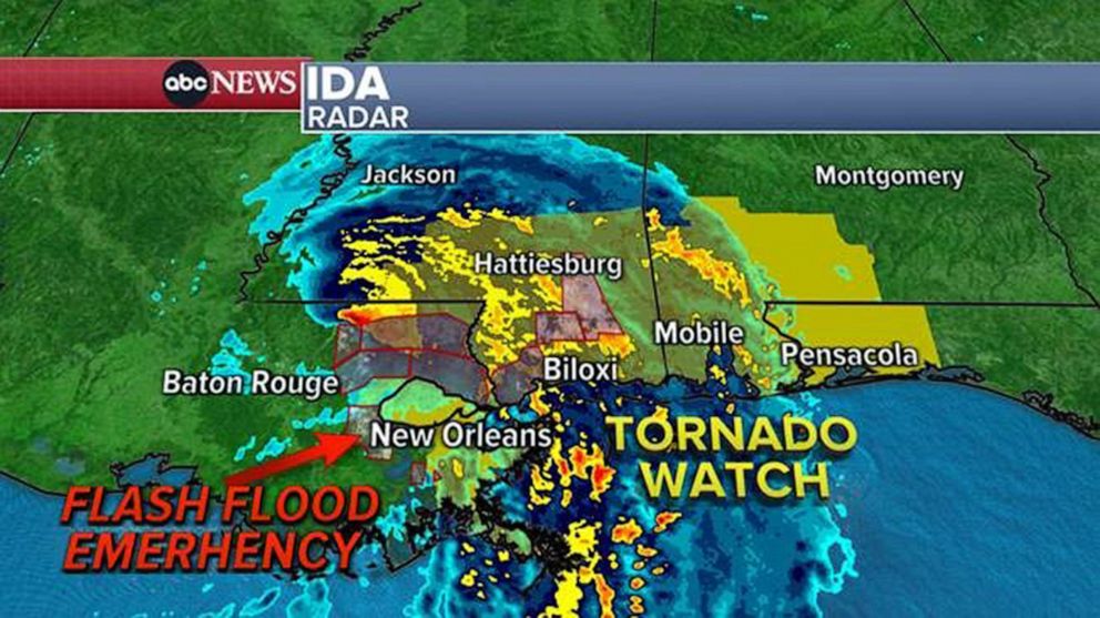
The National Weather Service also declared a flash flood emergency for Lafitte and Jean Lafitte, Louisiana, on Sunday night due to heavy rain and storm surge reportedly causing a levee to fail. Citing local law enforcement, the National Weather Service said more than 200 people were in "imminent danger" and urged people to "seek higher ground now!"
Heavy rainfall from Ida will continue Monday in southeastern Louisiana and spread northeast into the Lower Mississippi Valley. Total accumulations of 10 to 18 inches, with isolated maximum amounts of 24 inches, is possible across southeastern Louisiana into far southern Mississippi through Monday, according to the National Weather Service.
Storm surge, hurricane and tropical storm warnings remain in effect from Louisiana to the Alabama-Florida border. A tornado watch is also in place from Louisiana to the Florida Panhandle until 6 a.m. CT.
Ida is forecast to turn to the northeast on Monday and track across the Middle Tennessee Valley and Upper Ohio Valley through Wednesday, dumping rain throughout the region, according to the National Weather Service.
-ABC News' Max Golembo and Samantha Wnek