Ida downgraded to tropical storm
About 16 hours after making landfall in Louisiana, Ida was downgraded from a hurricane to a tropical storm early Monday morning.
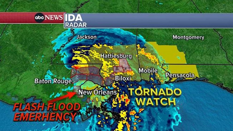
As of 4 a.m. CT, Ida was moving north at 8 miles per hour with the eye of the storm located about 95 miles south-southwest of Jackson, Mississippi, and 50 miles north-northeast of Baton Rouge, Louisiana. The storm's maximum sustained winds have decreased near 60 miles per hour with higher gusts, according to an advisory from the National Weather Service.
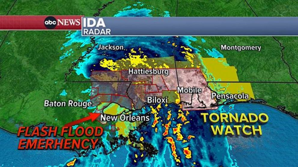
The storm surge warning has been discontinued from Morgan City to Grand Isle, Louisiana. The hurricane and tropical storm warnings have been discontinued west of Grand Isle. The hurricane warning has been replaced with a tropical storm warning from Grand Isle to the mouth of the Pearl River, including Lake Pontchartrain, Lake Maurepas and metropolitan New Orleans. Storm surge and tropical storm warnings remain in effect for Grand Isle to the Alabama-Florida border, according to the National Weather Service.
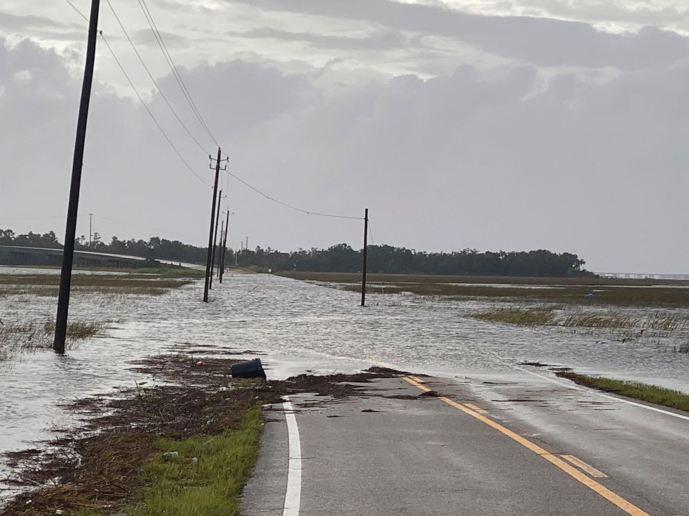
Meanwhile, 16 states from Mississippi to New Jersey are still on alert for flash flooding. A flash flood watch is in place from the Gulf Coast to New Jersey.
So far, the highest rainfall total was recorded in LaPlace, Louisiana, which received 15 inches. A flash flood emergency remains in effect there, according to the National Weather Service.
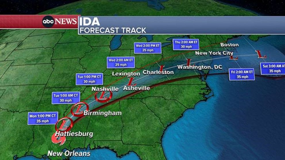
Ida is forecast to rapidly weaken even more over the next day or so, becoming a tropical depression by Monday evening.
The storm will move farther inland over southeastern Louisiana early Monday and into southwestern Mississippi later in the morning. Ida is then forecast to move over central and northeastern Mississippi on Monday afternoon and evening before moving across the Tennessee Valley on Tuesday, according to the National Weather Service.
-ABC News' Max Golembo